
An everchanging and other-worldly landscape of deserts, canyons and hoodoos, Utah is the prime destination for an epic west coast USA road trip. From Utah’s Mighty-5 national parks, state parks and canyons, this incredible 8-day Southern Utah road trip is perfect for first time visitors to the area.
Having visited the west coast of the USA several times in the past, we’d embarked on a variety of road trips across California, Nevada and Arizona, but Utah had remained largely unexplored. Flying from Manchester to Las Vegas provided the perfect starting point to cross the border from Nevada and map out a circular Southern Utah road trip covering around 1400 miles.
Disclosure: Making bookings through links on this page will earn me a small commission and assist in the upkeep of this website at no extra cost to you. Thank you for your support.
AN EPIC SOUTHERN UTAH ROAD TRIP ITINERARY
Whether its hiking, biking, high adrenaline adventures or relaxing in beautiful resorts surrounded by dramatic scenery, Southern Utah ticks all the boxes and provides a playground for all seasons. The hot desert summers make way for snow covered landscapes through winter, and within short journeys you can travel from dramatic canyons to high altitude forests. Variety is the spice of life, and Southern Utah has that in abundance.
The state of Utah covers almost 85,000 square miles, with Southern Utah being home to the Mighty-5 national parks – Arches, Bryce Canyon, Canyonlands, Capitol Reef, and Zion. There are also a wealth of state parks and national monuments with dramatic scenery at every turn. Jaw dropping other-worldly landscapes will wow, while the heat haze on long desert roads will make you feel like you’re in a movie. Think classic westerns or Thelma and Louise and you get the idea. This epic eight-day Southern Utah road trip itinerary provides only a glimpse of what’s on offer but will leave you longing to head back. I fell in love with Southern Utah – read on to see why.
OUR SOUTHERN UTAH ROAD TRIP ROUTE
SOUTHERN UTAH ROAD TRIP – WHERE TO START?
If travelling from overseas, the best options to start your Southern Utah road trip are by flying into Las Vegas or Salt Lake City, both having direct flights from the UK. Our transatlantic airline of choice was VIRGIN ATLANTIC and having been collecting Virgin Points regularly for the last 15 years or so, we utilised the points for direct Upper Class flights from Manchester to Las Vegas. Arriving in Las Vegas early in the afternoon, we opted to stay overnight and collect our vehicle the following morning to set off on our adventure.

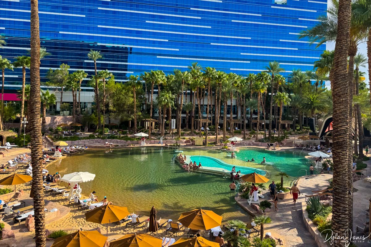
Having visited Las Vegas several times in the past, we stayed off strip as we wanted to relax, before getting an early night. Our overnight stay in Las Vegas was at the VIRGIN HOTELS LAS VEGAS, located ten minutes or so from the airport, making it ideal to head back to the airport to pick up the car the following morning. Virgin Hotels Las Vegas was the perfect place for an overnight stay – it had just enough ‘Vegas’ about it, without being too full on. With a good-sized casino, there were numerous bars, restaurants and quick food options, as well as entertainment and three great pools.


The main pool area can apparently have quite the party vibe, however it was low-key on the day we visited. We lounged around, had a quick dip to cool down from the warm desert heat and sipped a couple of poolside drinks before grabbing a slice of pizza, a drink at the bar and desperately trying to stay awake past eight PM. Our room – a Strip View King Chamber was spacious with views across to the lower strip and a glimpse of The Sphere. It was great to watch darkness fall, and the strip hotels light up.

GETTING AROUND SOUTHERN UTAH
If you’re planning to explore further afield than the Mighty-5 national parks on your Southern Utah road trip, the key factor to consider when hiring a car is to make sure the vehicle has high clearance and four wheel drive capabilities. To explore some of the more remote and surreal landscapes of the state, your journey will take you off the main paved roads and onto rough and bumpy gravel roads. Whilst these might look like ‘real’ roads on the map, they can be more challenging with deep ruts. A number of destinations we visited involved traversing these types of terrains, and whilst we didn’t fully off-road, we 100% needed a high clearance vehicle.

Our ride of choice for the week was a JEEP COMPASS TRAILHAWK. This superb SUV had great off-road capabilities and was really comfortable for long journeys. Our vehicle was booked through SIXT at the Las Vegas Car Rental Center – a few minutes’ shuttle bus journey from the airport terminals.
DAY 1 – THE JOURNEY TO BRYCE CANYON
LAS VEGAS > BRYCE CANYON: 270 MILES
The first day of the road trip and with excitement and anticipation we headed to collect our Jeep. A super-efficient service from SixT and we were soon our way out of Vegas and heading onto the I-15 North, with 200 miles or so to travel. Crossing the border from Nevada into Arizona briefly, the I-15 headed through the impressive Virgin River Gorge for 29 miles, with towering walls of colourful rock to both sides and the Virgin River flowing nearby. Heading into Utah, the cities of St. George or Cedar City were ideal stopping points for fuel, lunch and a trip to Walmart to stock up on car snacks and water.
TOP TIP: Nevada and Utah have different time zones, with Utah being an hour ahead on Mountain Standard Time. This will essentially add an hour on to your journey, so be sure to factor this into your planning.
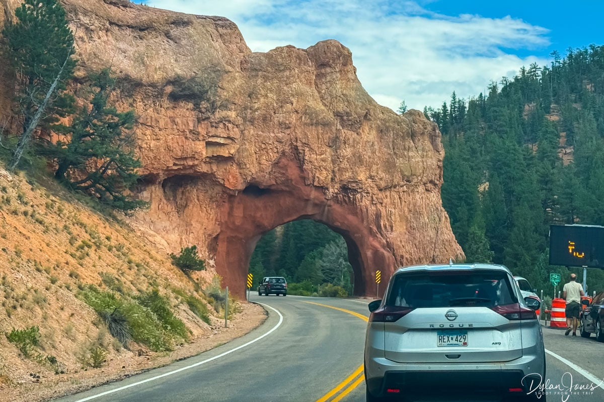
Exiting the I-15, the journey into BRYCE CANYON NATIONAL PARK was approximately one hour, the final stretch taking in the western end of the stunning Scenic Byway 12. This included Red Canyon, where the landscapes really started to change, featuring red rock formations, towers and columns, the road passing under two impressive red rock arches. Another ten miles or so to the turn off for Bryce Canyon City, we headed to the National Park entrance and Visitor Center.
TOP TIP: If you’re visiting a number of National Parks on a US road trip, consider purchasing an AMERICA THE BEAUTIFUL NATIONAL PARK PASS. At an increased cost of $250 per vehicle for the 2026, this annual pass provides access to all the major national parks, providing a significant saving over paying at each park, especially with some hefty surcharges implemented to enter certain national parks without a pass.
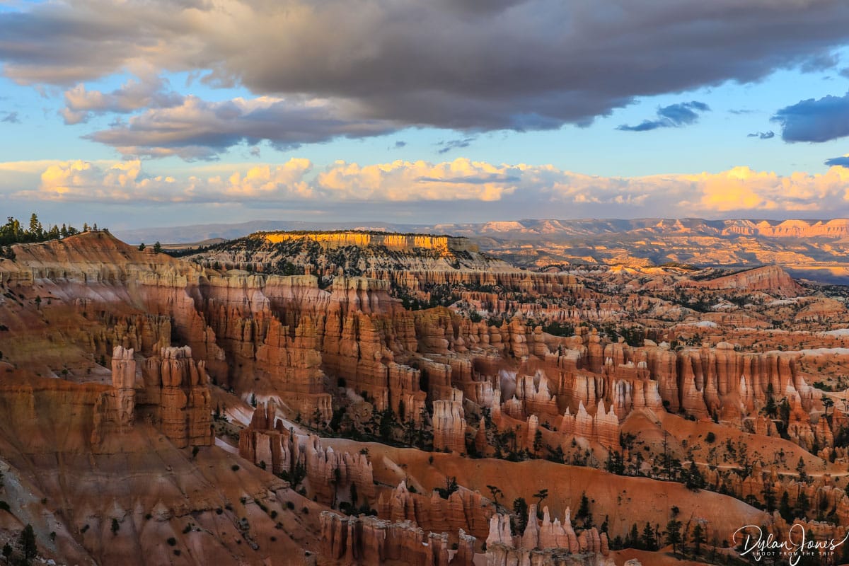
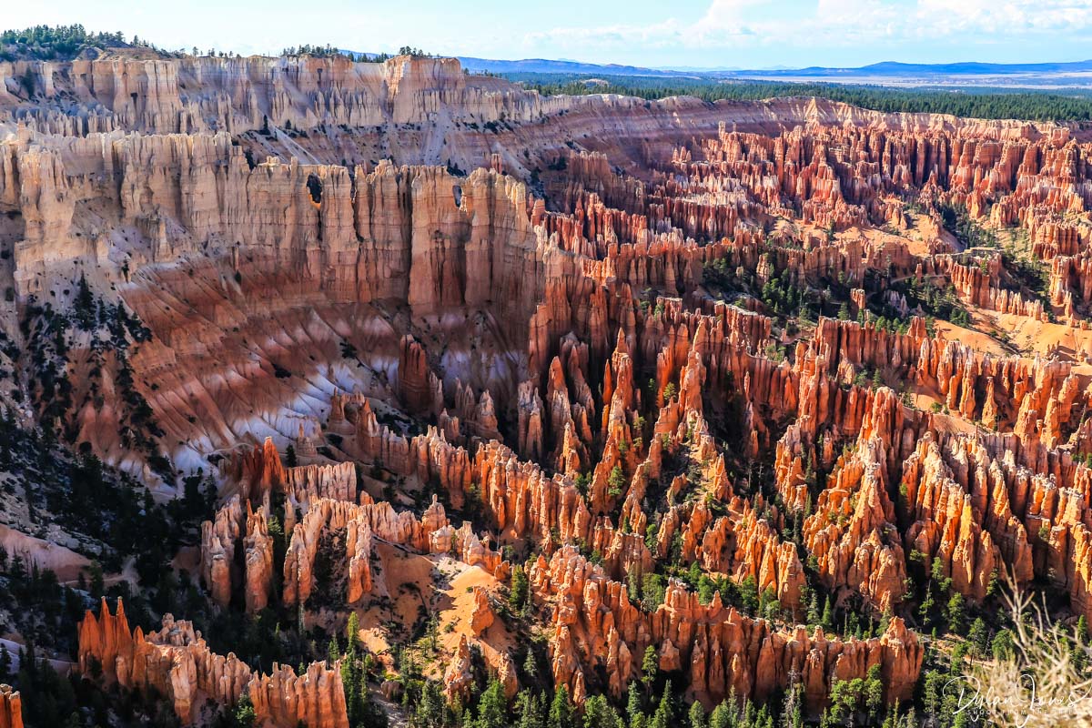
BRYCE CANYON’S EPIC VIEWPOINTS | Before heading to our accommodation at Bryce Canyon, we took in some of the scenic viewpoints from the main national park road including BRYCE POINT, PARIA VIEW and INSPIRATION POINT. The scale was vast, and the scenery incredibly beautiful.

WHERE TO STAY IN BRYCE CANYON?
Our first accommodation of this Southern Utah road trip was BRYCE CANYON LODGE, located next to the Bryce Amphitheater rim. A more expensive choice than many nearby lodgings, the convenient location was ideal for exploring the national park without needing to drive.
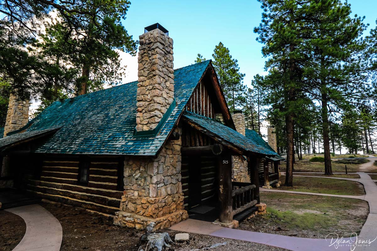
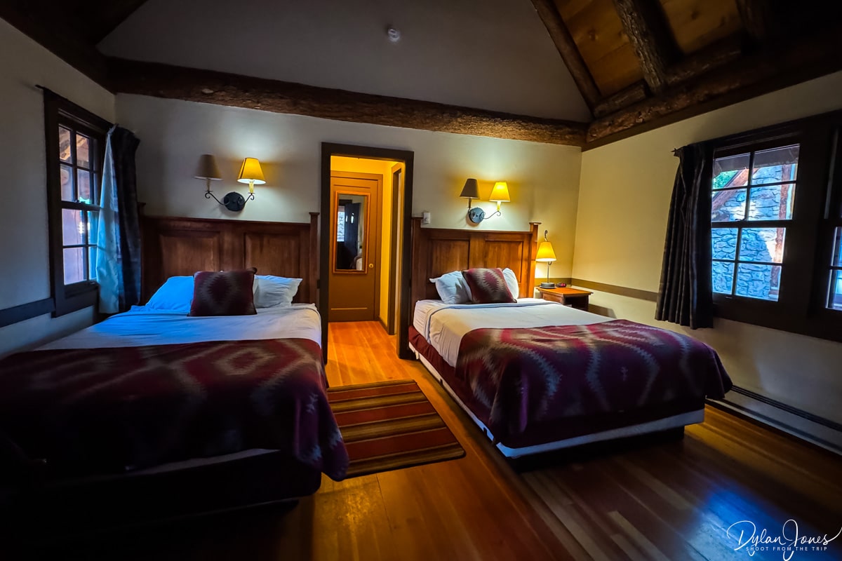
Having checked in to our rustic cabin, we headed out to SUNSET POINT before dinner – an overlook with a view looking northeast across Bryce Amphitheater. As the sun set behind us, the colours of landscape ahead of us changed and with storm clouds hovering over the canyon, we were provided with a dramatic scene of distant downpours and a beautiful rainbow.

Heading back to Bryce Canyon Lodge, we dined at the onsite restaurant, located in a beautiful historic dining room with large stone fireplaces. A fabulous three-course dinner washed down with a couple of local beers and we were ready for an early night.
UTAH ROAD TRIP DAY 2 – EXPLORING BRYCE CANYON AMPHITHEATER
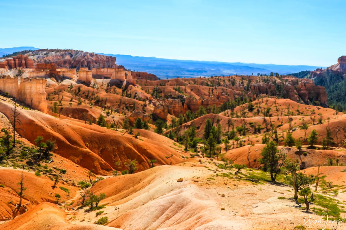
EXPLORING BRYCE CANYON: CAR FREE DAY
With our accommodation in the heart of the national park, this would be a day of exploring by foot. We’d planned a couple of hikes alongside spending some down time at Bryce Canyon Lodge. Still getting used to the time difference from the UK, there was no issue getting up for an early start to capture the most wonderful sunrise.
The cabins at Bryce Canyon Lodge sit conveniently in between Sunrise Point and Sunset Point – both being a ten minute walk away. Despite the warm daytime temperatures in Bryce Canyon, the temperature really dipped overnight so we needed to wrap up warm to head out to catch our first sunrise.
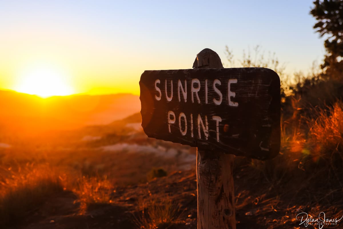
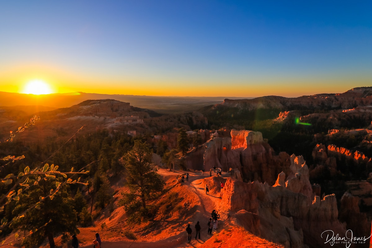
With people gathering in anticipation at SUNRISE POINT, the sun finally reached the horizon casting bright shades of orange and yellow across the clear skies. The previously muted shades of the landscape exploded with colour – bright oranges and pinks with the towering hoodoos casting deep shadows across the canyon.

We’d planned two hikes into the Amphitheater that day. Having fuelled up on my go-to American breakfast of eggs (over-easy), bacon and hash browns we put on our hiking boots and set off out to explore.
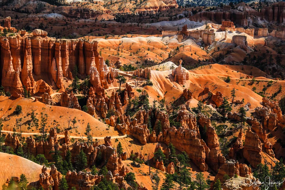
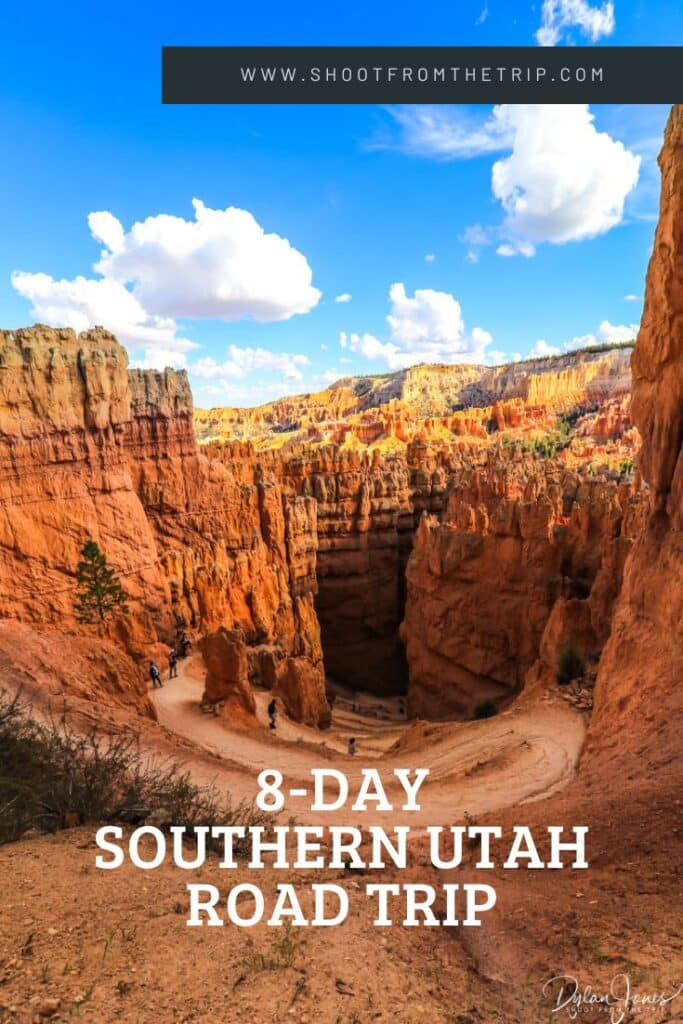
MORNING HIKE – QUEEN’S GARDEN & NAVAJO COMBINATION LOOP | One of the most popular hikes in Bryce, this 2.9 mile circular hike headed into Bryce Amphitheater from Sunrise Point passing by a number of iconic viewpoints including the Queen Victoria hoodoo and Thor’s Hammer, before passing through rock arches and ascending around 600 feet up to Sunset Point via the switchbacks of Two Bridges or Wall Street. We opted for the Two Bridges route, as we planned to tackle Wall Street in the afternoon. Both routes featured a series of steep switchbacks surrounded by tall rock walls.

LUNCH BREAK | Lunch options at Bryce Canyon Lodge include either the Bryce Canyon Dining Room or Valhalla Pizza located in an outbuilding of the hotel complex. Both offered a simple menu of light bites and sandwiches with the latter offering pizzas, alongside hot and drinks, beers and wine.
AFTERNOON HIKE – NAVAJO & PEEKABOO COMBINATION LOOP | Our afternoon hike was slightly longer than the morning hike at 4.9 miles and saw us take on one of Bryce Canyon’s most iconic landmarks – Wall Street. Starting from Sunset Point, Wall Street features a series of switchbacks down a steep section into the canyon, surrounded by towering hoodoos and rock faces. This unique landscape leads down into a short slot canyon, before opening out onto the Navajo Loop trail. At the point where the Navajo and Queen’s Garden trails meet, there’s an additional pathway that leads onto the Peekaboo Loop – a quieter trail that leads further into Peekaboo Canyon, with incredible scenery and some jaw dropping ‘wow’ moments.


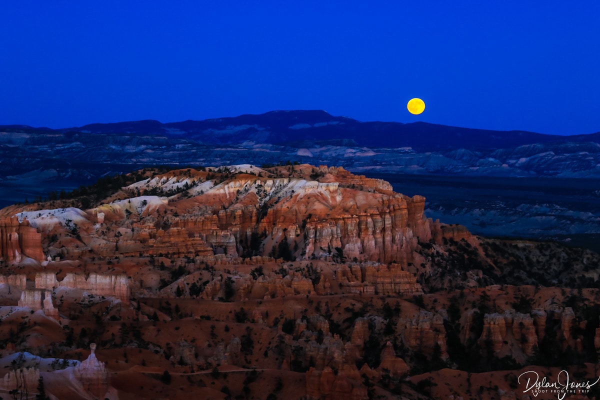
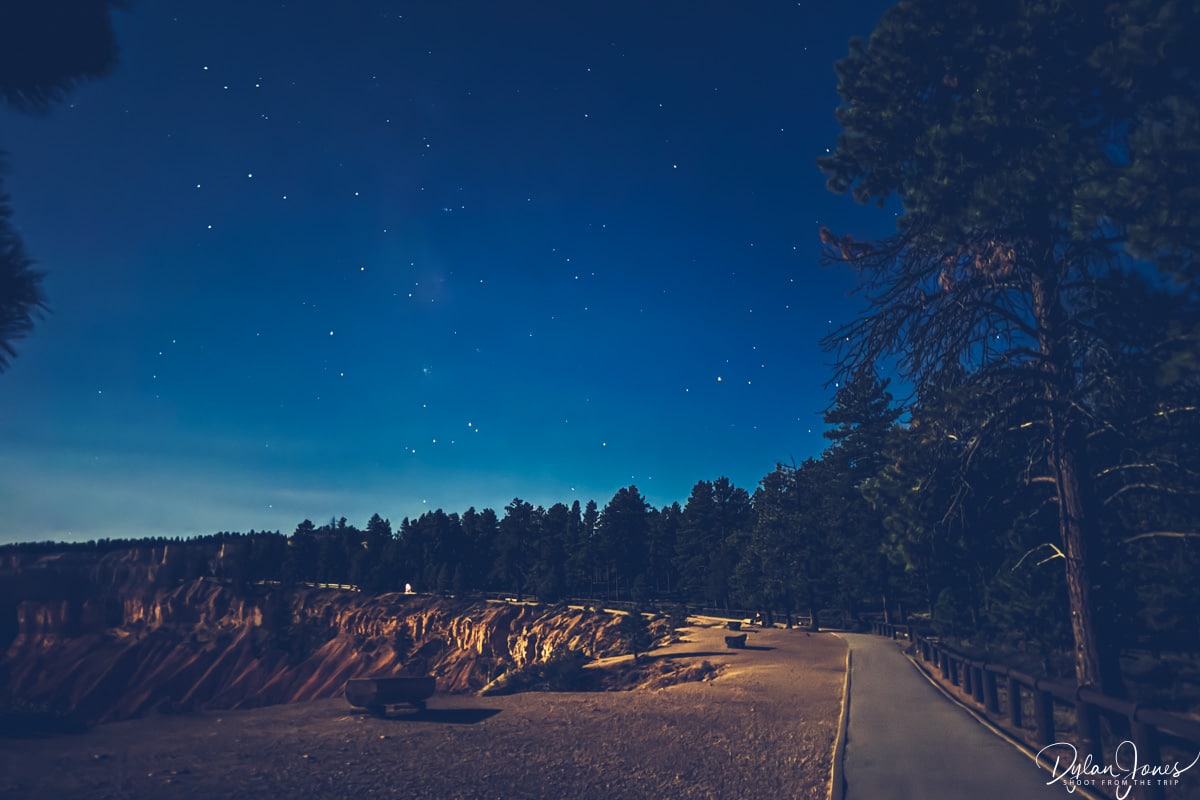
Bryce Canyon’s remote location makes it ideal for stargazing, so once darkness falls it’s worth heading across to the canyon rim to gaze up at the dark skies. Unfortunately, our visit coincided with a full moon which detracted from clear views of the milky way, but it was still a stunning night scene.
DAY 3 – SCENIC BYWAYS, A LUNAR LANDSCAPE AND GOBLIN HOODOOS

SCENIC BYWAY 12 > CAPITOL REEF NATIONAL PARK > MOONSCAPE OVERLOOK > GOBLIN VALLEY STATE PARK > MOAB: 310 MILES
Day 3 of this epic Southern Utah road trip took in some of the most jaw dropping scenery in the state. With more than 300 miles to cover as well as some short hikes, we set off early to ensure we could make the most of the day.
TOP TIP: For the long and more remote drives, we stocked up on lunch supplies from a store. Having a portable cool bag for the car was useful to keep our food and drinks chilled for the long journeys and hiking days.
120 MILES ALONG SCENIC BYWAY 12
First up was a 120-mile section of the aptly named Scenic Byway 12. Passing through the agricultural areas around Cannonville and Henrieville, we headed through Grand Staircase-Escalante National Monument with a great scenic viewpoint stop at HEAD OF THE ROCKS OVERLOOK, providing expansive views towards Escalante Canyons; the road snaking its way through the rocky landscape.
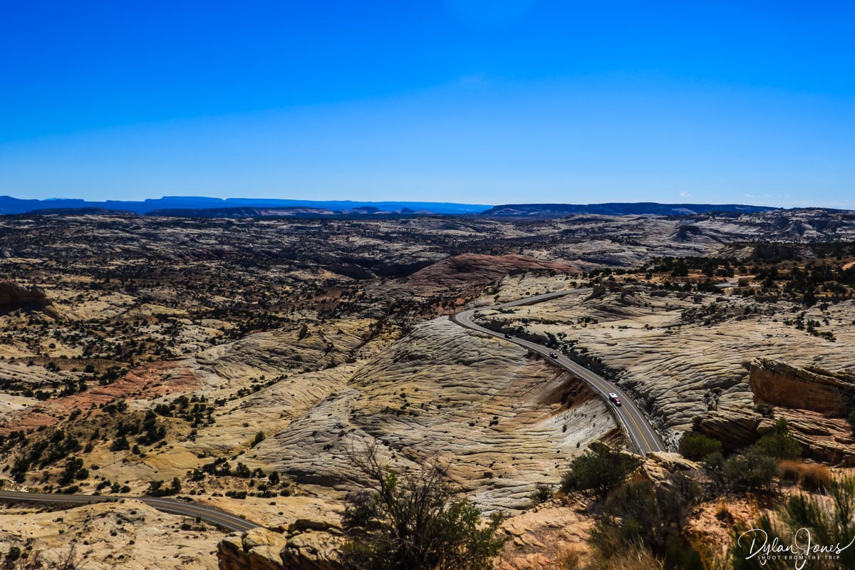
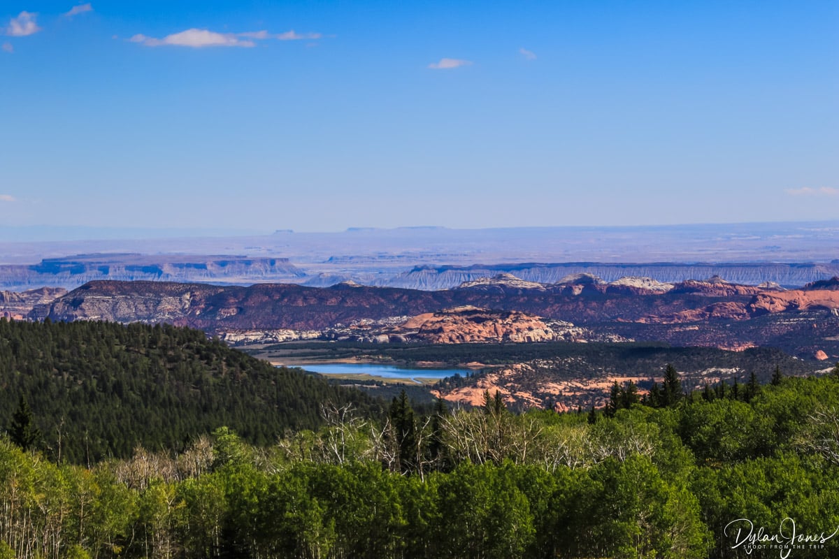
We then headed north towards Boulder via the dramatic HOGBACK section of road – a stretch of road sitting on a knife edge ridge with steep drop-offs to both sides. Passing through Boulder, the road climbed into the DIXIE NATIONAL FOREST, where canyons were replaced by forests of fir and aspen. Reaching an elevation of 9,600 feet, there were scenic viewpoints offering views east towards the canyons of Capitol Reef National Park – our next destination.
A HIKE IN CAPITOL REEF NATIONAL PARK
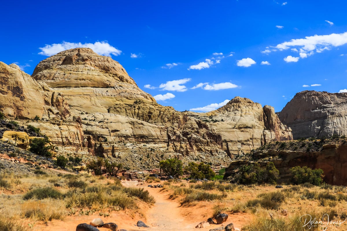
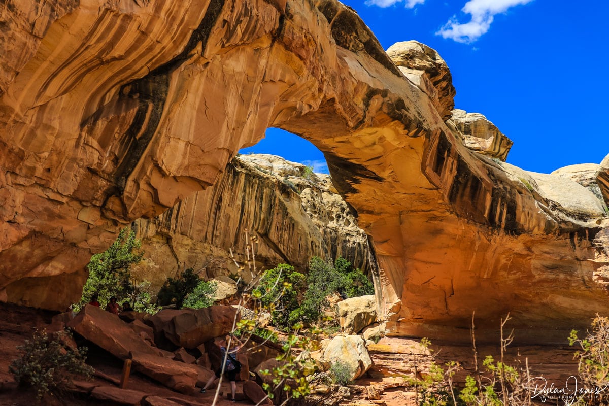
One of the Mighty-5 National Parks of Utah, Highway 24 passes through the heart of CAPITOL REEF NATIONAL PARK, which provided the perfect stop for a short hike. A quick pitstop at the Visitor Center, and we headed to the HICKMAN BRIDGE TRAILHEAD. From here, a short but rewarding 1.8-mile round trip hike with an elevation gain of 400 feet headed to the spectacular Hickman Natural Bridge – an archway spanning 133 feet. The trail looped under the bridge, and back to join the main trail before heading back. As well as the bridge, the trail provided some fantastic views of the landscapes of Capitol Reef National Park including the impressive Capitol Dome.
THE INCREDIBLE MOONSCAPE OVERLOOK
The next stop of our Southern Utah road trip was an eagerly anticipated one – a remote viewpoint accessed via a gravel road. About thirty minutes east of Capitol Reef, a gravel road (marker 6650 East) headed north from Highway 24 into the desert. This gravel road, or North Factory Butte Road, led to the imposing FACTORY BUTTE – a large 1000-foot-tall rock formation standing fortress-like in the desert. After a ten-mile journey on this gravel road, a right turn led onto Coal Mine Road – more of a dirt track in the desert, which after 2.5 miles literally ended at the edge of a cliff.

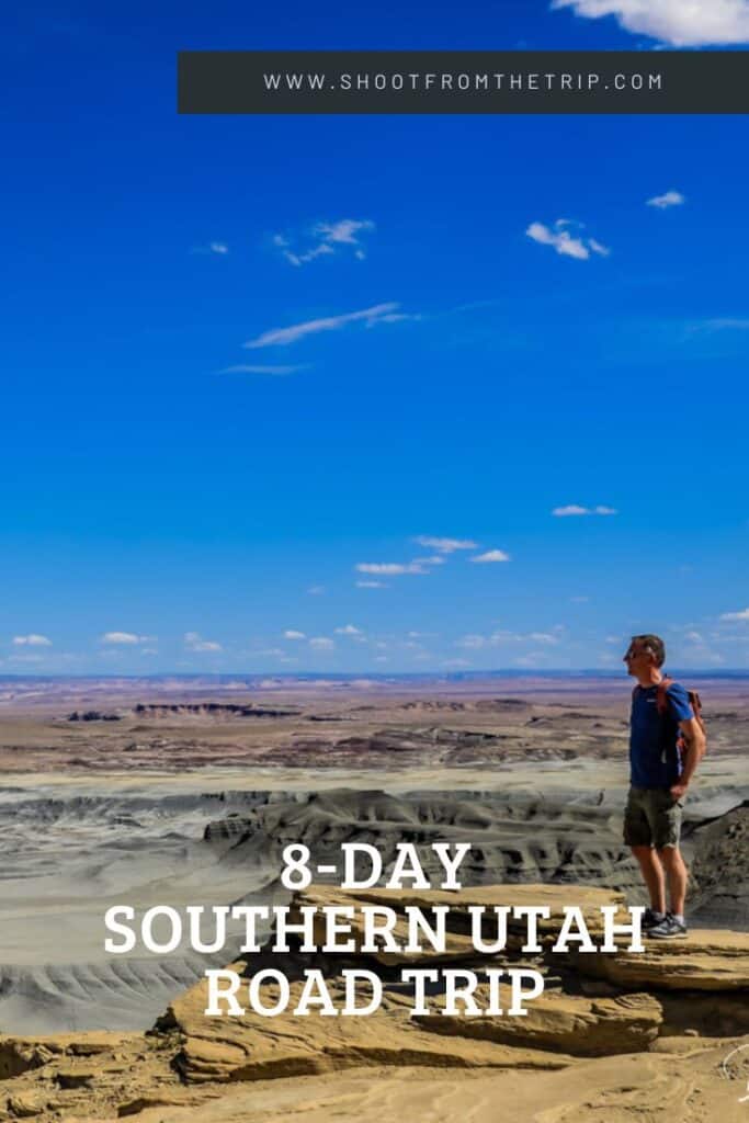
The reward for this bumpy and challenging drive was one of the most incredible scenes you’re likely to see on a Southern Utah road trip – MOONSCAPE OVERLOOK, also known as Skyline Rim Viewpoint. Standing on the edge of the cliff, with drops of up to 1400-feet, an expanse of barren landscape stretched out for miles ahead that really did look like another planet. Rocky hills and buttes stood out from the grey badlands – years of erosion showing the imprints of ancient waterways snaking their way through the landscape. I was in awe and with only another handful of cars in the area, had plenty of time to take in the incredible views in peace.


TOP TIP: A high clearance vehicle is necessary for visiting Moonscape Overlook. It’s also important to check local weather forecasts, as if there is a chance of rain, or if there has been rain recently, this route can get muddy and difficult to pass.
THE HOODOOS OF GOBLIN VALLEY STATE PARK
We had intended to do another nearby off-road adventure after leaving Moonscape Overlook, however, with storm clouds brewing around us we made the decision to continue on. Heading east towards Hanksville, we stopped for gas at the unique HOLLOW MOUNTAIN GAS STATION, before continuing to visit yet more surreal landscapes at GOBLIN VALLEY STATE PARK. Entry was not included with our National Park Pass, so we paid the $20 private vehicle fee, made the customary visit to the visitor center, and set off to explore.

While there are several hiking trails here, due to the time limitations, we headed to the Goblin Overlook parking lot providing access to Valley of the Goblins. This three-square mile area of the park is covered with thousands of hoodoos – mushroom, or goblin, shaped rock formations. Walking among the hoodoos, it was a fascinating area to explore and learn about the creation of these unique rock formations.

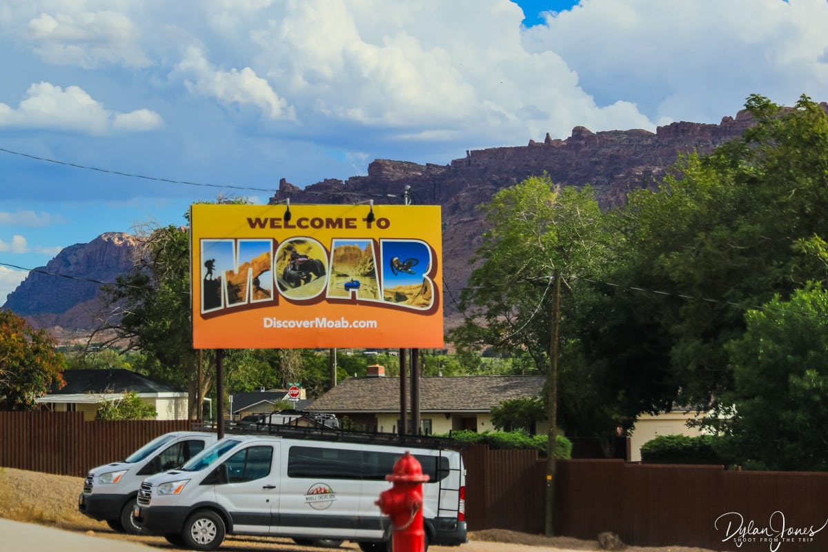
From here the final 100 mile stretch of our journey would take us to the desert city of MOAB, where we based ourselves for three nights. This desert adventure playground is the perfect base to explore various national and state parks, as well as partaking in some adrenaline adventures such as mountain biking, off-roading and white-water rafting.
WHERE TO STAY IN MOAB?
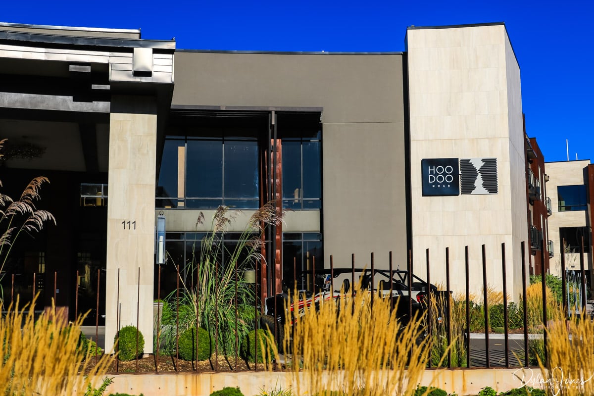
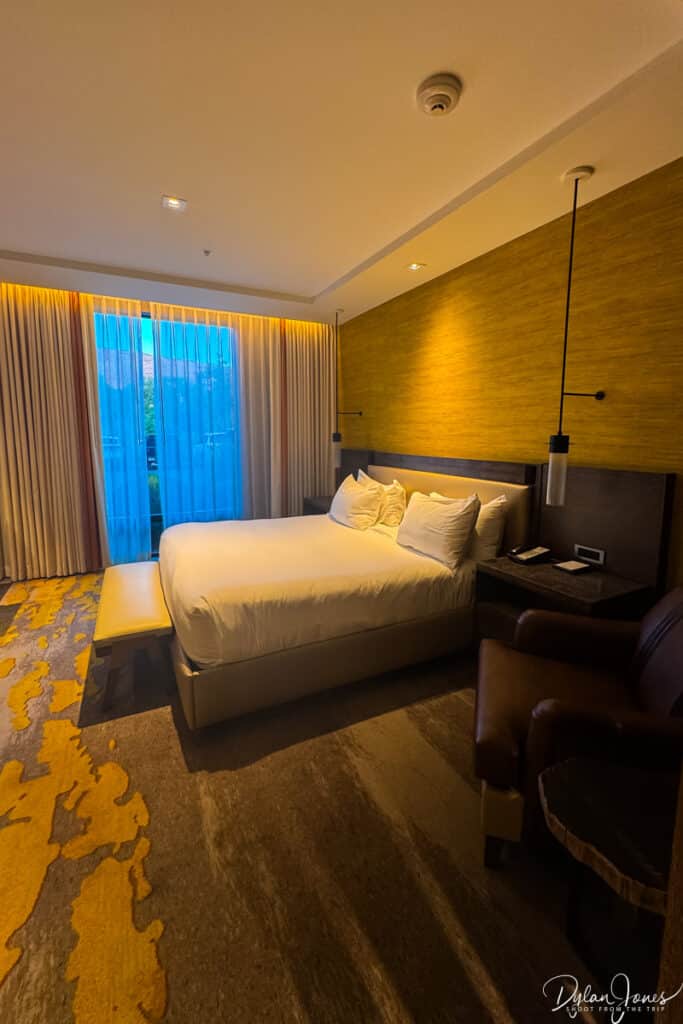
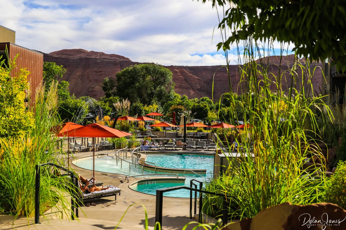
Our accommodation in Moab was the incredible HOODOO MOAB; a stylish Curio Collection by Hilton hotel with an incredible setting and mountain backdrop. We wanted to splash out on quality accommodation in Moab, as although we’d be out exploring, we were keen to make sure we had some downtime to relax and enjoy our surroundings.

UTAH ROAD TRIP DAY 4 – A DAY AT ARCHES NATIONAL PARK

MOAB > ARCHES NATIONAL PARK > MOAB: 46 MILES ROUND TRIP
A good night’s sleep followed by a hearty breakfast and we were ready to set out on the fourth day of our Southern Utah road trip, which would take us to ARCHES NATIONAL PARK. Located only four miles from Moab, the entrance to Arches can be found directly off US Highway 191. As one of the busier US National Parks, Arches implemented a timed entry system for the 2025 season to keep the flow of traffic and visitors to a reasonable level. We had booked our entry between 9am and 10am, to allow plenty of time to explore.
TOP TIP: Booked via the RECREATION.GOV website, timed entry is only required during certain parts of the year costing £2.00 per private vehicle, in additional to the standard entry fee or pass.
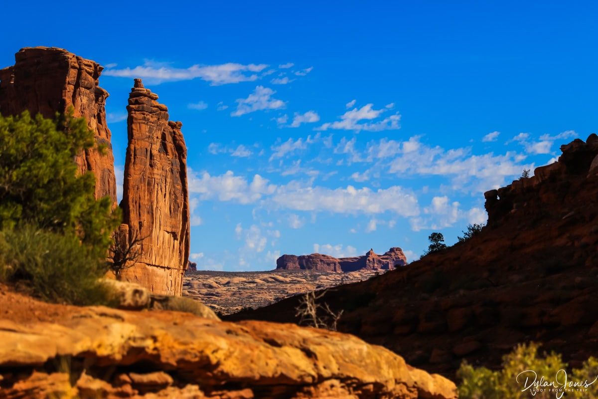
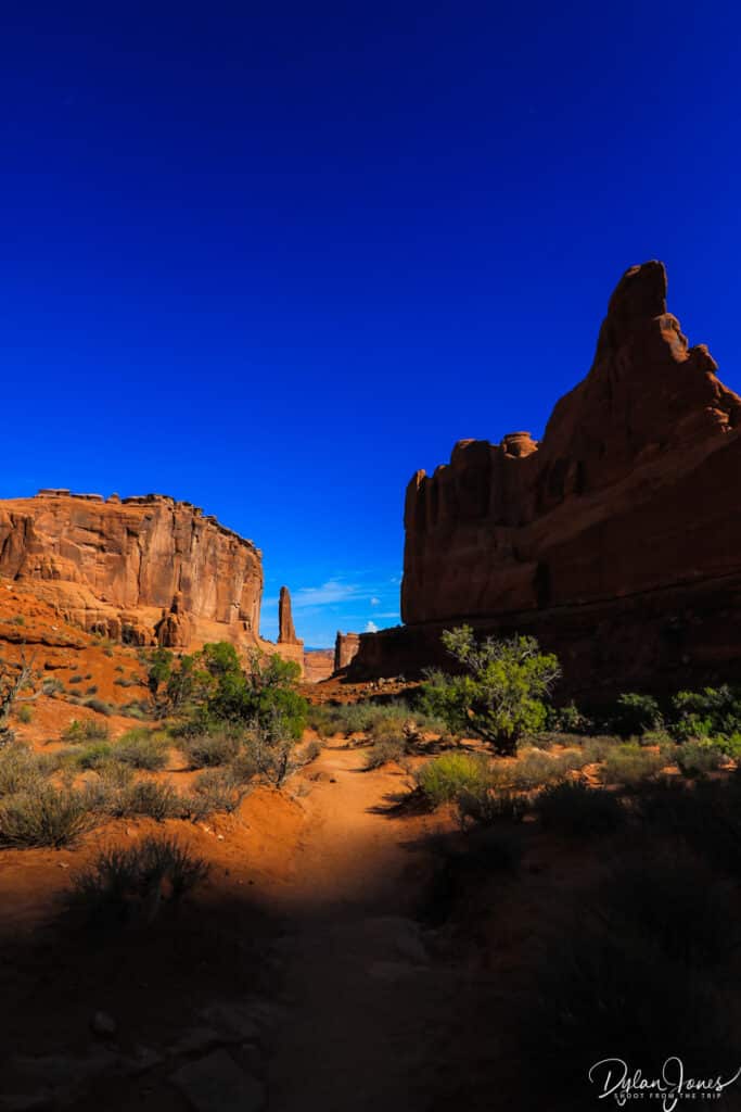
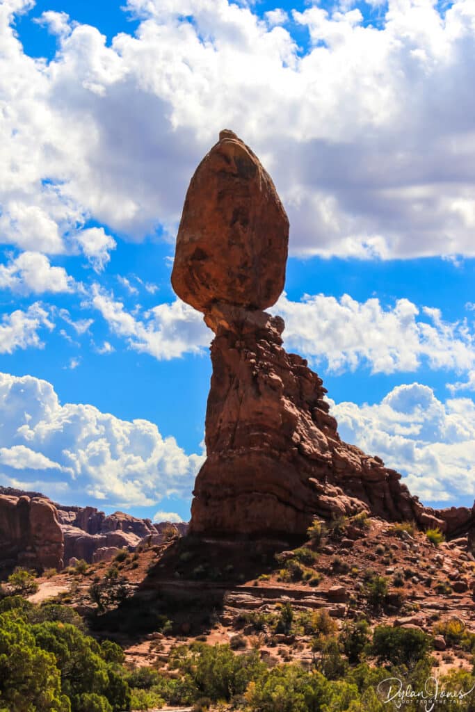
Covering almost 120 square miles and featuring over 2,000 natural stone arches, Arches National Park is vast but has a fantastic road network with parking lots near all main viewpoints and trailheads. Most of the viewpoints are only a short walk from the parking areas, with several easy to moderate hikes under three miles. Our plans were fairly fluid as we (correctly) expected that many of the parking lots would be full, so we would choose our route as we went.
Highlights of our day included an incredible walk through PARK AVENUE, surrounded by towering walls of rock to both sides, partly cast in dark atmospheric shadows as the sun was rising to the east. A hike through DEVILS GARDEN at the far end of the park rewarded us with views of the the impressive LANDSCAPE ARCH, the longest arch in North America, as well as having an encounter with a sizeable snake on the sandy trail.

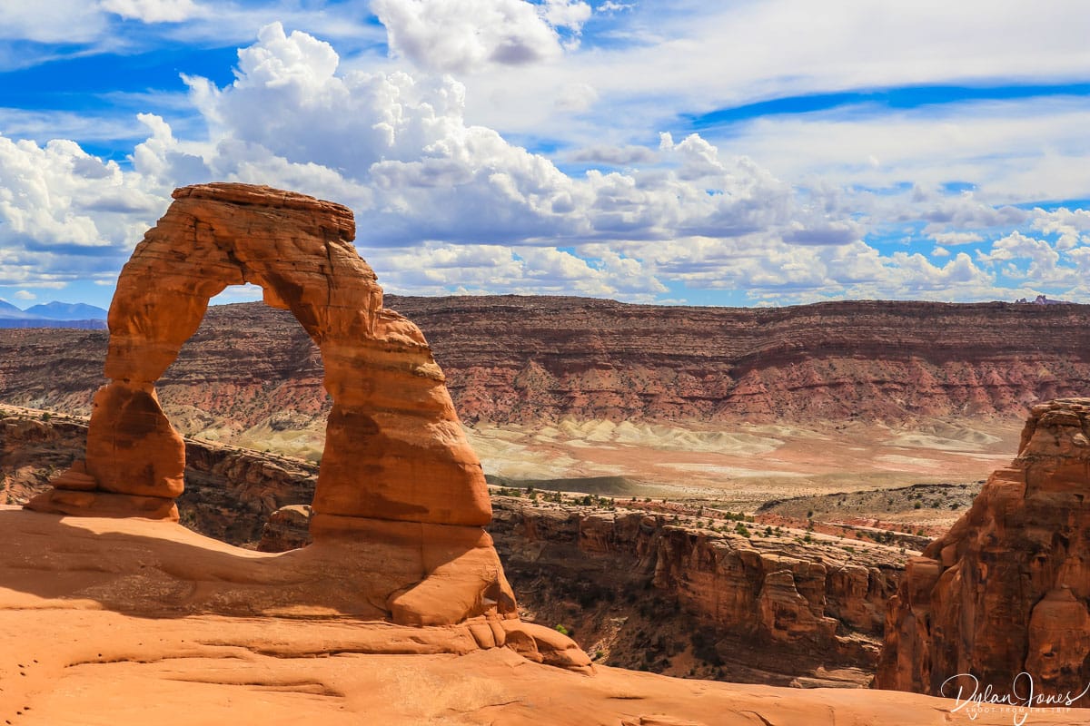
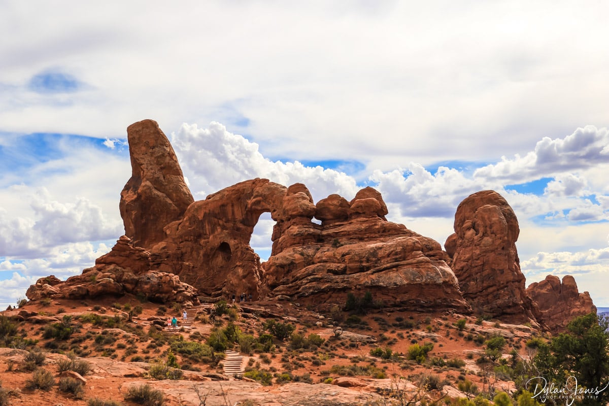
We started off the afternoon with a hike to DELICATE ARCH – a three-mile round trip hike with an elevation gain of 480 feet. Whilst the route wasn’t too challenging, the final section wasn’t ideal for those with a fear of heights, with a traverse along a pathway carved into the side of the cliff. The resulting views were worthwhile with the impressive 46 foot high Delicate Arch being the largest free-standing arch in the park. A final stop at NORTH WINDOW and SOUTH WINDOW, and we made our way back to Moab.
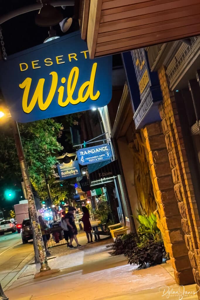
Rewarding ourselves with a couple of hours at the stunning pool area of the Hoodoo Moab, we enjoyed a poolside beer or two after having a dip, before enjoying a fantastic steak dinner at JOSIE WYATT’S GRILLE and taking an evening stroll around Moab, to the background sounds of a chorus of cicadas and the warm breeze of the desert air.

DAY 5 – A DAY OF CANYONS AND OVERLOOKS
MOAB > CANYONLANDS > DEAD HORSE POINT STATE PARK > POTASH ROAD > MOAB: 105 MILES ROUND TRIP
After an excellent breakfast at JAILHOUSE CAFE, we stopped at a local cooperative grocery store to stock up on water, snacks and sandwiches before setting off to visit the fourth of our Mighty-5 Utah National Parks. Located west of Moab, CANYONLANDS NATIONAL PARK comprises is made up of several districts spanning its 527 square miles. The northern district of the park, ISLANDS IN THE SKY, is accessed via the UT-313 road about 10 miles northeast of Moab. To the southeast, the NEEDLES DISTRICT is accessed via Highway 191 and the final district in the southwest, THE MAZE can only be accessed by hiking.

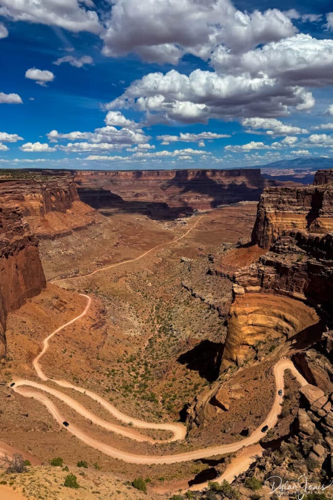
ISLANDS IN THE SKY | The most popular district to visit, we stopped off at the Visitor Center and crossed the road to our first vista point. This overlook provided a sure-fire taste of what was to come as well as the impressive Shafer Trail winding through the desert. Standing at the edge of the cliff, deep red rock canyons carved from years of erosion stretched out as far as the horizon. We stopped at a number of further viewpoints deeper into the park.
CANYONLANDS HIGHLIGHTS
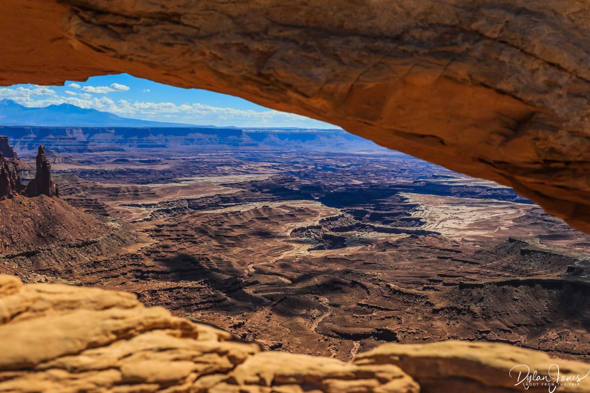
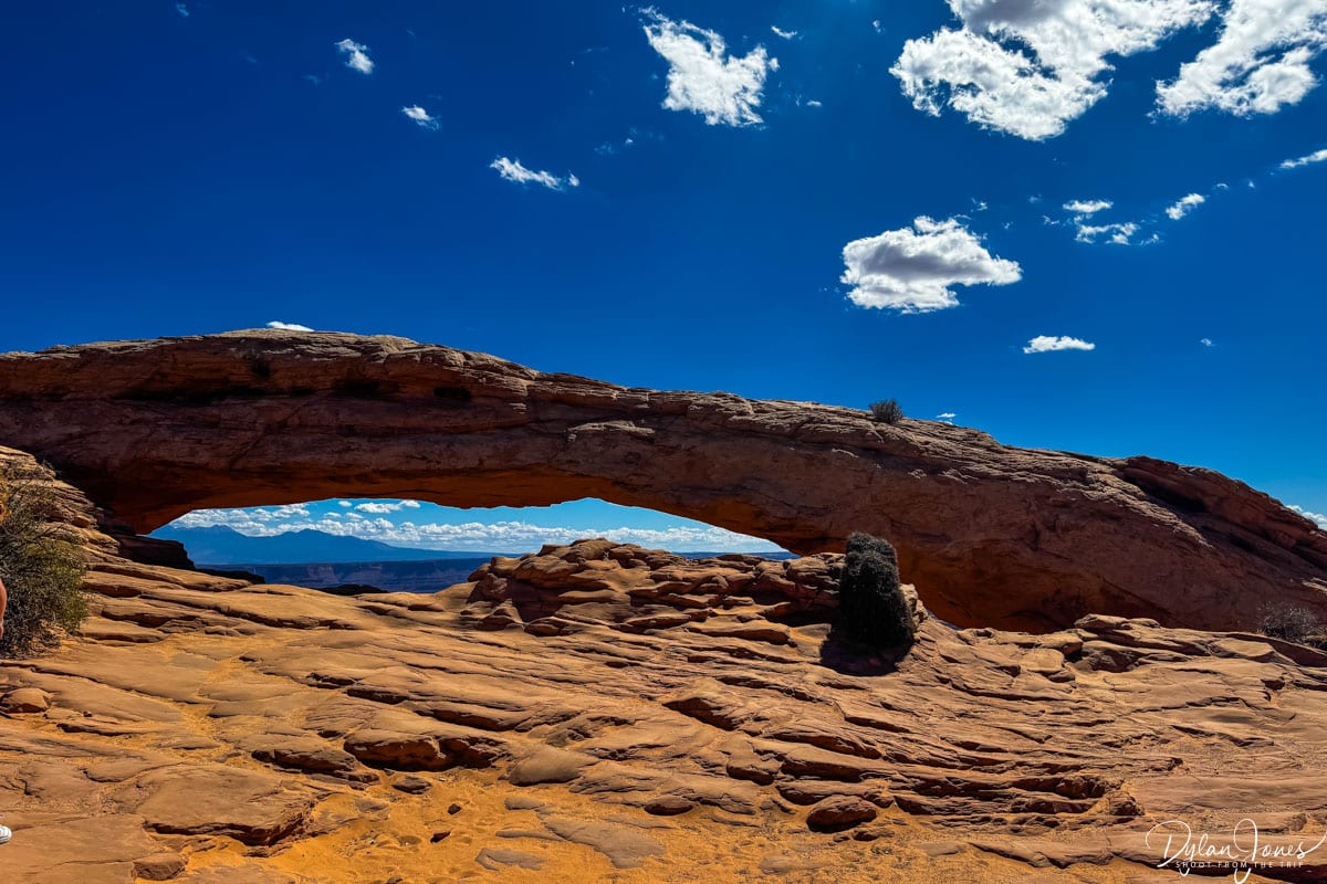
MESA ARCH | A short hike from the parking lot, Mesa Arch offered a window frame to Buck Canyon and Washer Woman Arch with the backdrop of the La Sal Mountains.
WHITE RIM OVERLOOK | A 1.8-mile round trip hike to an impressive viewpoint of the White Rim. A simple trail to follow with very little elevation change, this trail followed a simple path along the top of a mesa which narrowed to a point at the overlook, offering unobstructed views of the White Rim of the canyon far down below.
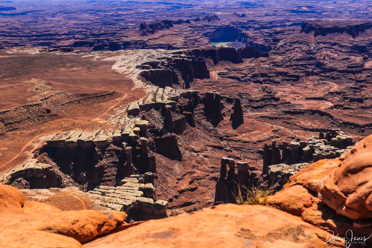
GREEN RIVER OVERLOOK | Looking west, Green River is located in the canyon to the west of the Islands in the Sky. A short walk from the parking lot, this viewpoint provided a wide vista showing the Green River 1,300 feet below in a deep canyon. The size and scale of this vista was a lot to take in and so impressive.
UPHEAVEAL DOME | Our final stop in Canyonlands and a short drive from the Green River Overlook, the Upheaval Dome parking lot provided access to a short hiking trail to the edge of the dome – a unique rock formation which formed a circular depression much like a crater.

A VISIT TO DEAD HORSE POINT STATE PARK
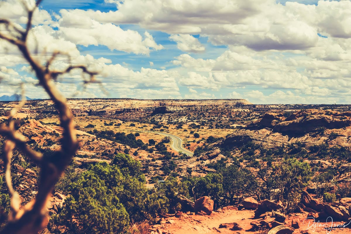
One detour that we couldn’t miss was DEAD HORSE POINT STATE PARK. As with other state parks, entry was not included with the National Park Pass, so a $20.00 fee per private vehicle was required. Located close to Islands in the Sky, Dead Horse Point featured a Visitor Center and number of overlooks, viewpoints and short hikes offering some staggering canyon views.
The highlight was DEAD HORSE POINT OVERLOOK, with a spectacular view of the Colorado River snaking its way around a horseshoe canyon. As a point of interest, the road section below the main viewpoint was the location of the infamous ending of ‘Thelma and Louise’.

THE RED CLIFFS OF POTASH ROAD
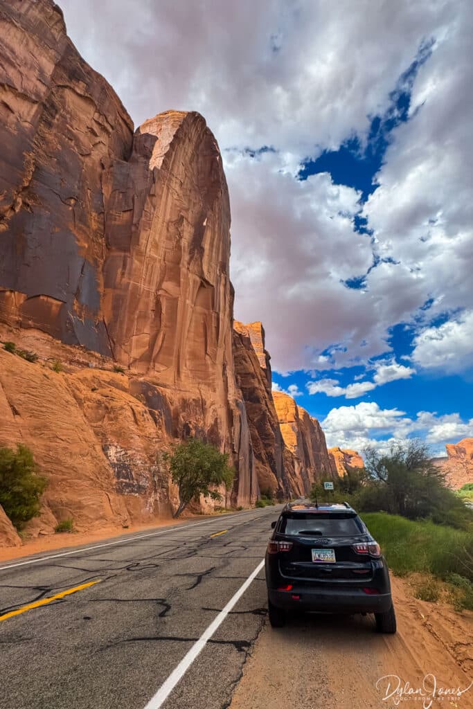
Our final stop of the day was POTASH ROAD. This scenic byway north of Moab followed a stretch of the Colorado River with towering sandstone cliffs to the other side of the road.

UTAH ROAD TRIP DAY 6 – THE INCREDIBLE MONUMENT VALLEY (IN ARIZONA)
MOAB > FORREST GUMP POINT > MONUMENT VALLEY: 150 MILES
Day six of our Southern Utah itinerary saw us heading south and crossing the border into Arizona to visit one of the most iconic landscapes of southwest USA – Monument Valley. With an expected drive time of about two hours and forty-five minutes, we joined the US-191 which passed directly through Moab and headed south. This straightforward journey continued for around 100 miles, at which point the US-193 merged into the US-163, heading southwest and passing through the small town of Mexican Hat.
FORREST GUMP POINT
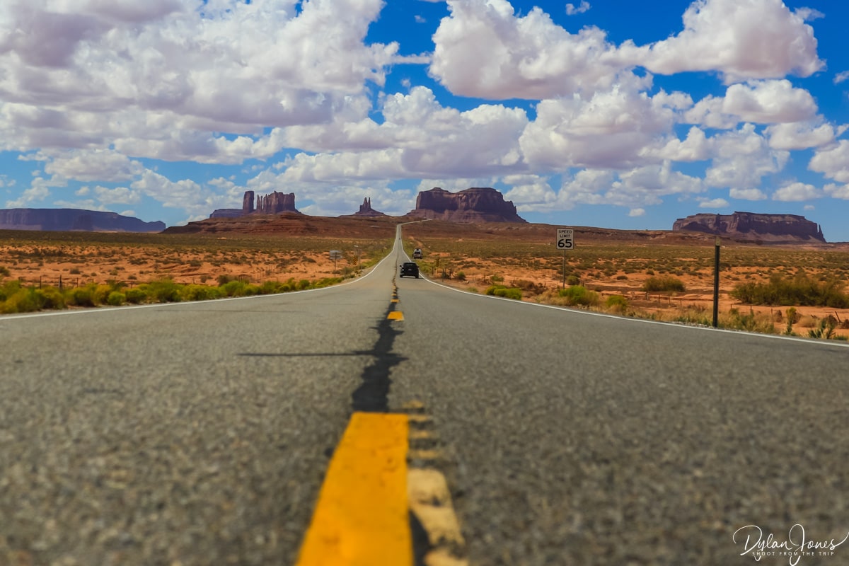
Heading west from Mexican Hat, the desert road straightened, the red rocks and buttes of Monument Valley appearing on the horizon. Whether you’ve seen the 1994 movie Forrest Gump or not, this landmark viewpoint along the US-163 is iconic. The long and straight desert road dropping and then climbing towards the red rock formations in the distance is an image I have seen many times in print. When I passed by in 2003, there was no reference to Forrest Gump, but this spot is now very popular. After a very brief stop, we continued our journey to Monument Valley.
MONUMENT VALLEY NAVAJO TRIBAL PARK
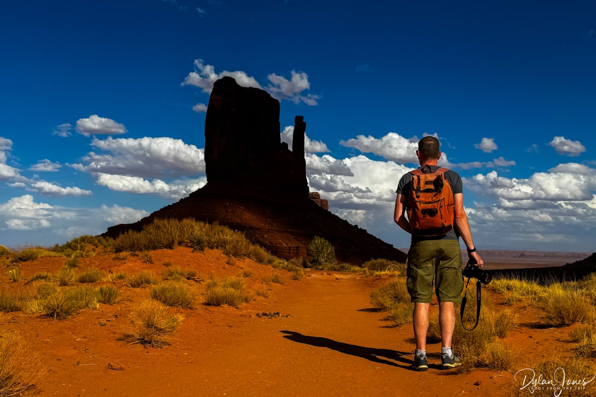
Arriving at the spectacular Monument Valley is quite something. From one movie location to another, Monument Valley feels like stepping into a classic western movie. The three iconic red rock buttes of East Mitten, West Mitten and Merrick Butte stand proudly within the wilderness and unspoilt desert landscape of the Tribal Park.

Bordering Utah and Arizona, Monument Valley offers a vast landscape of sandstone towers and rock formations, including a 17-mile scenic drive, hiking trails and visitor facilities.
TOP TIP: Entry to the Monument Valley Tribal Park is $15.00 per person (based on 2026 pricing) and can be booked online in advance or at the fee booth approaching the park entrance.
The park is managed by the Navajo Parks and Recreation Department and while visitors are warmly welcomed, it’s important to respect the landscapes, traditions and rules of the Navajo people. This is sacred land and should be treated as so.
MONUMENT VALLEY SCENIC DRIVE
Having arrived at Monument Valley Visitor Center at lunchtime, we grabbed a quick bite before setting off to explore the park. First up was the Monument Valley Scenic Drive – a 17-mile circular route on an unpaved gravel road, with several pull-out areas and parking lots dotted around the route.
As per previous experiences on unpaved roads, a high clearance vehicle was required, ideally with 4WD capabilities. The first section of the route headed downhill on a relatively sandy and rutted section. Getting down was no problem, however there were some real struggles getting back up with many cars getting stuck in the soft sand. It took us three attempts in our 4WD Jeep Compass.
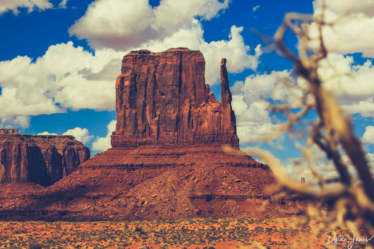
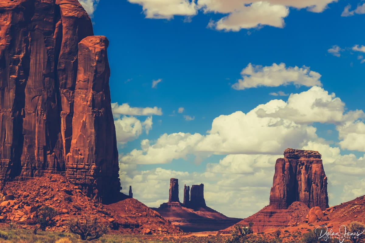
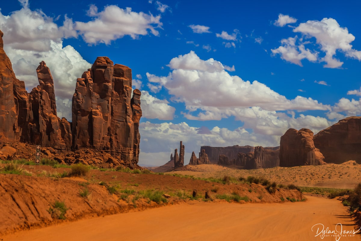
The scenic drive was an incredible opportunity to get up close to the sandstone buttes and towers, ensuring we remained on the designated route. With 11 clear stops along the way, there was plenty of opportunity to wander and take in the magnificent scenery of the valley with some key highlights.
JOHN FORD’S POINT – One of the first major stopping points with iconic views, arts and crafts vendors, including Linda’s Café offering her famed Navajo Fry Bread.
NAVAJO CODE TALKER OUTPOST – An elevated viewpoint overlooking the buttes towards the far end of the circular route.

HIKING IN MONUMENT VALLEY
The only designated hiking routes in Monument Valley are the WILCAT TRAIL and the LEE CLY TRAIL which start at the Visitor Center. Any other hiking or exploration of the Tribal Park should only be carried out with a Navajo guide. We headed out onto the Wildcat Trail which followed a route down into the valley, circling West Mitten Butte before heading back. With very little elevation change, this was a great little hike despite the desert heat, and we only met one other couple of on the route.

SUNSET AT MONUMENT VALLEY
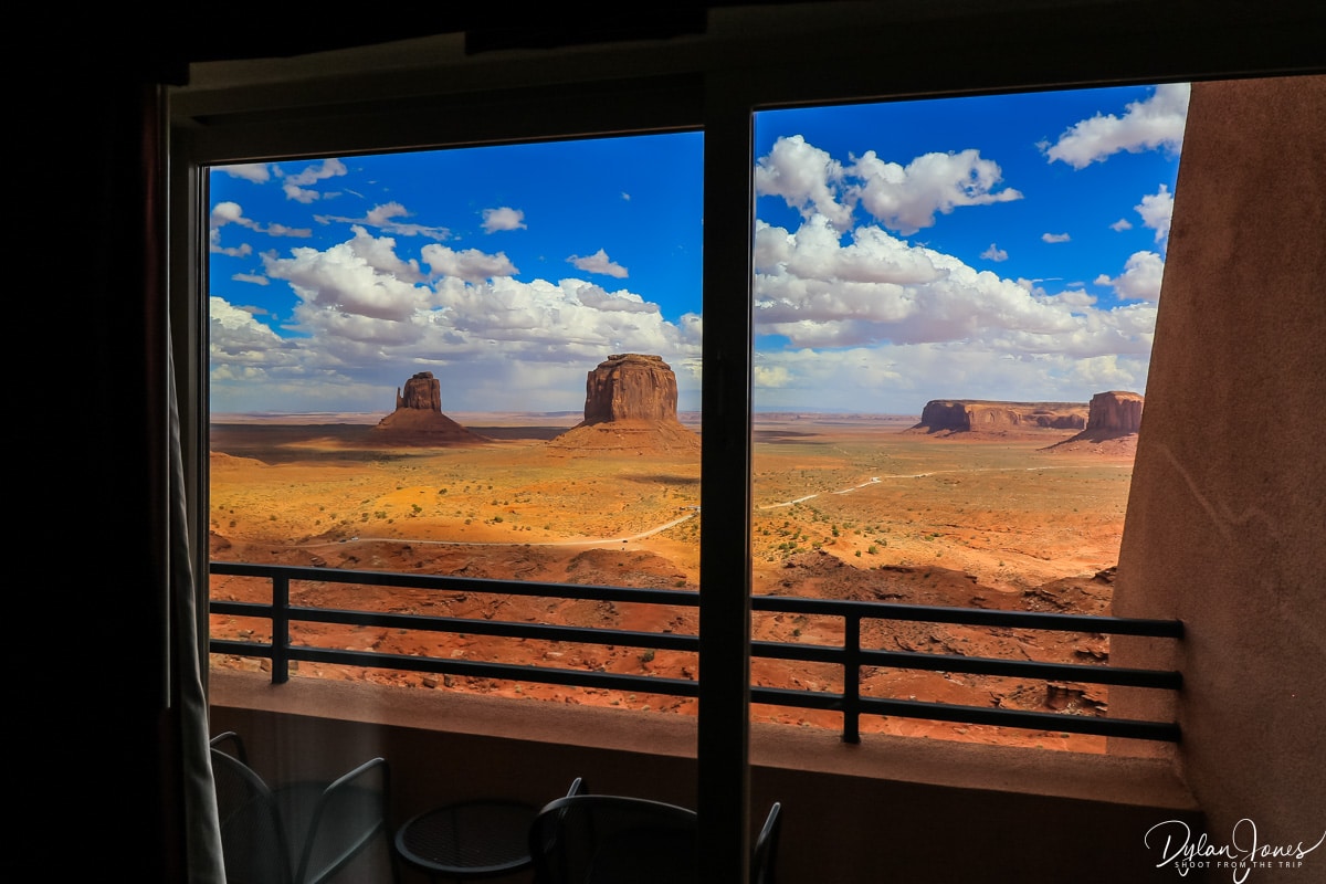
A key benefit of spending the night at Monument Valley was the opportunity to witness a sunset and sunrise. Looking down at the valley from the deck of The View Hotel with an east facing aspect, the sun set behind the hotel, casting shadows across the Mittens and Elephant Butte. We lucked out with our timing to see the MITTEN SHADOW – an event that only happens twice a year when the setting sun casts a shadow of the West Mitten onto the East Mitten.

WHERE TO STAY IN MONUMENT VALLEY?
Our accommodation for the evening was THE VIEW HOTEL; the only accommodation located within the Monument Valley Navajo Tribal Park. All rooms in the three-storey sand coloured building had a southeast facing aspect with balconies overlooking ‘The View’ of the Mittens, meaning you could enjoy sunrise and sunset directly from your balcony. With its subtle design and colour scheme, the building almost blended into the landscape when viewed from the valley floor.

Onsite, THE VIEW RESTAURANT offered meals throughout the day with the evening menu serving a simple range of American and Navajo dishes including stews, burgers and salads, as well as some Mexican dishes. The food was tasty and the service efficient and friendly. It’s worth noting that the hotel and restaurant do not serve alcohol, which is illegal on the Navajo Indian reservation. They did have a range of alcohol-free beers and wines alongside soft drinks.
DAY 7 – HORSESHOES, SLOT CANYONS AND ZION
MONUMENT VALLEY > HORSESHOE BEND > WIRE PASS SLOT CANYON > ZION NATIONAL PARK: 265 MILES
The weather gods were against us for our Monument Valley sunrise with cloud cover and occasional breaks offering us a glimpse of what we could have seen. That said, it was still amazing to take in the dramatic views as the morning light crept in, before we headed out for breakfast, followed by spending some last moments on the balcony as the skies brightened.

Day eight of our Southern Utah road trip was another long one, covering 265 miles in total. This was also another interesting day in terms of time zones, as we were heading out of the Monument Valley into Arizona before dipping back into Utah further along the way. While Monument Valley is on the same time zone as Utah, Arizona itself does not observe daylight saving time during the summer so is an hour behind. Bags packed, we loaded up the dusty Jeep and headed off.
A QUICK HIKE TO HORSESHOE BEND
A drive through Arizona on the US-16, US-160 and the US-98 bought us to the city of Page on the shores of Lake Powell, where we made our first scenic stop of the day at HORSESHOE BEND. This popular scenic viewpoint was busy when we arrived late morning. We paid the $10 fee per vehicle to park and set off on the 0.6 mile trail the viewpoint. Of all places we had visited during our trip, this was by far the most congested. With a fenced viewpoint at the edge of the cliff, we patiently waited for a spot and were rewarded with an incredible view where the green tinged Colorado River had carved out a horseshoe shaped canyon some 1000 feet below.

WIRE PASS SLOT CANYON & BUCKSKIN GULCH
Heading back through Page and crossing the Glen Canyon Dam, we continued west for an hour on the US-89, before making a left turn onto a gravel road towards the Wire Pass Trailhead. This large parking area was ten miles away from the main road, with limited phone signal. Our plan was to take a hike to our first proper slot canyon.
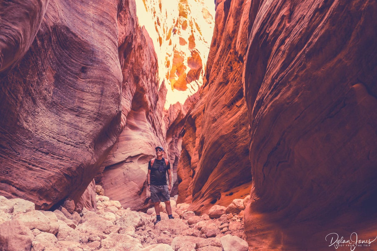
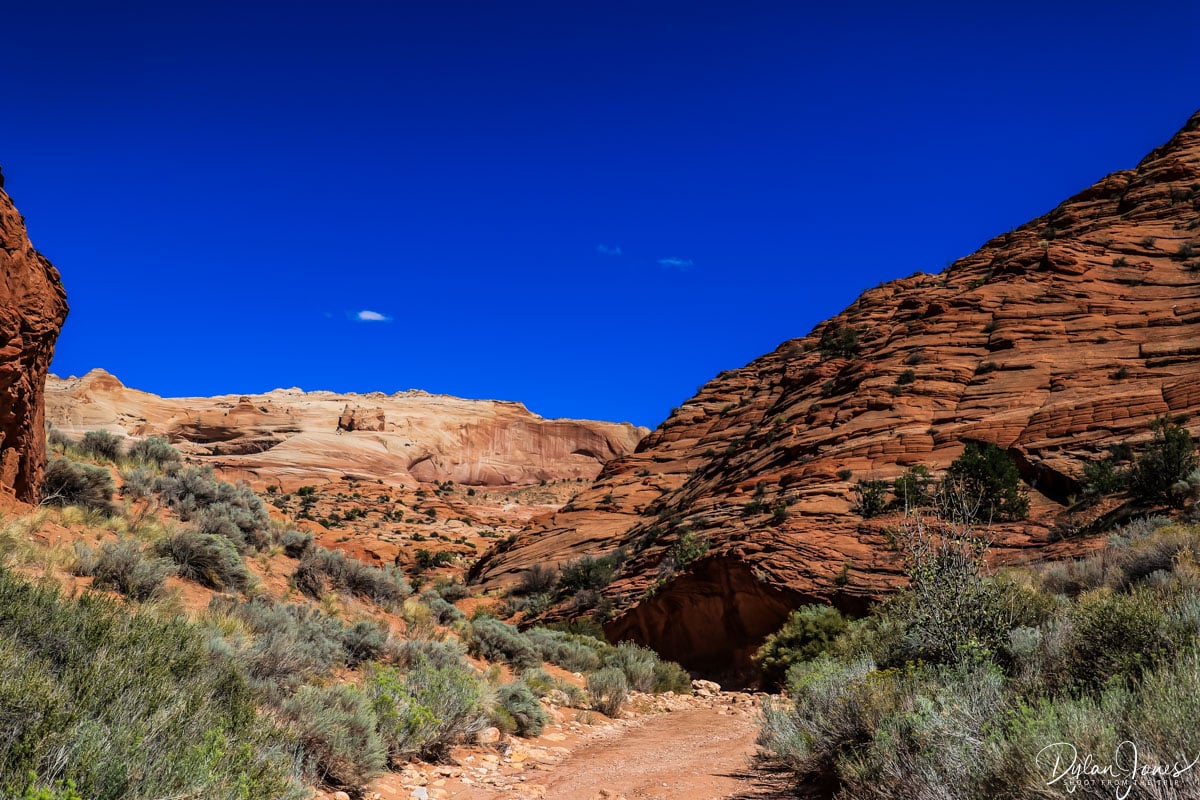
WIRE PASS SLOT CANYON is a relatively short slot canyon that leads to the much larger BUCKSKIN GULCH. Reaching Buckskin Gulch from the Wire Pass Trailhead takes around 45 minutes with Buckskin being 20 miles long and up to 200 feet deep in some sections. Given our time constrains, our plan was to head through Wire Pass Canyon and hike a short section of Buckskin Gulch before turning back. The hike from the trailhead followed a wash, or dry riverbed, for just over mile before entering the canyon. The simple and relatively flat trail was easy to navigate and offered some impressive scenery, with large sandstone rock formations contrasting against the deep blue sky.
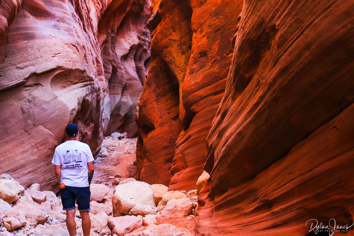
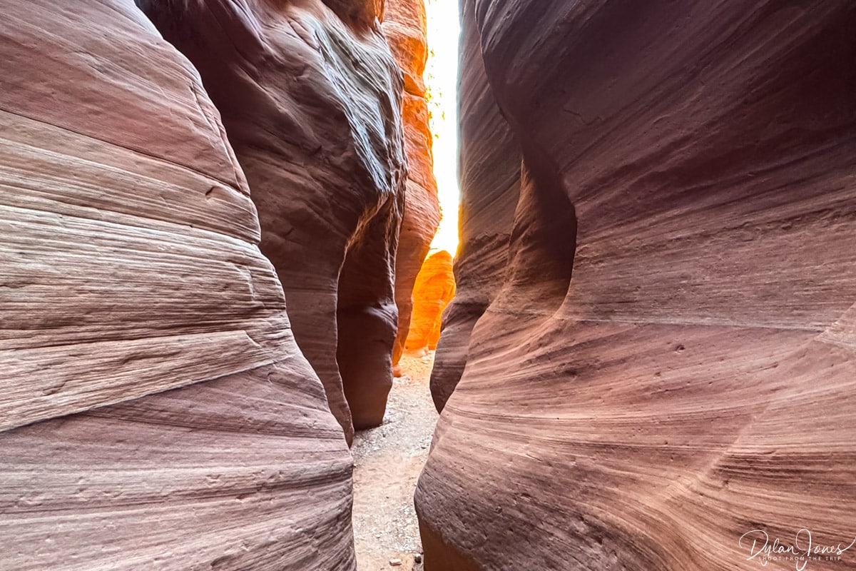
Entering the canyon, the sandstone walls rose and closed in to both sides, with a wooden ladder leading down about fifteen feet down into the canyon. The route became narrow and tight, but atmospheric beyond compare. Looking up at the towering walls of rock, sunbeams cascaded in casting interesting shadows. After a short hike, the canyon widened into a large opening with ancient petroglyphs carved into the large rock face. Ahead, a left or right turn led into Buckskin Gulch, where we headed south for a short while before turning back.
TOP TIP: A permit is required for Wire Pass Trailhead which can be purchased on RECREATION.GOV for a $6.00 fee person. We booked in advance, but there is an unmanned box to pay at the trailhead. This trailhead is also the starting point THE WAVE trail, but permits are on a limited lottery basis and difficult to get hold of. Be sure to check the weather forecast before entering any slot canyons. Flash floods can occur rapidly, even if the rain is upstream.
ZION – MOUNT CARMEL HIGHWAY
From the Wire Pass Trailhead, our plan was to set off towards Zion National Park, allowing time to do a couple of short hikes on the way. The universe had other ideas, and we arrived back to the Jeep which wouldn’t start, thanks to a flat battery. Perfect. We managed to get hold of the rental company who were going to send out roadside assistance but by some chance the (Welsh) guy in the pick-up next to us had some jump leads and we eventually got the car started to set off on our journey 1.5 hours later than planned.
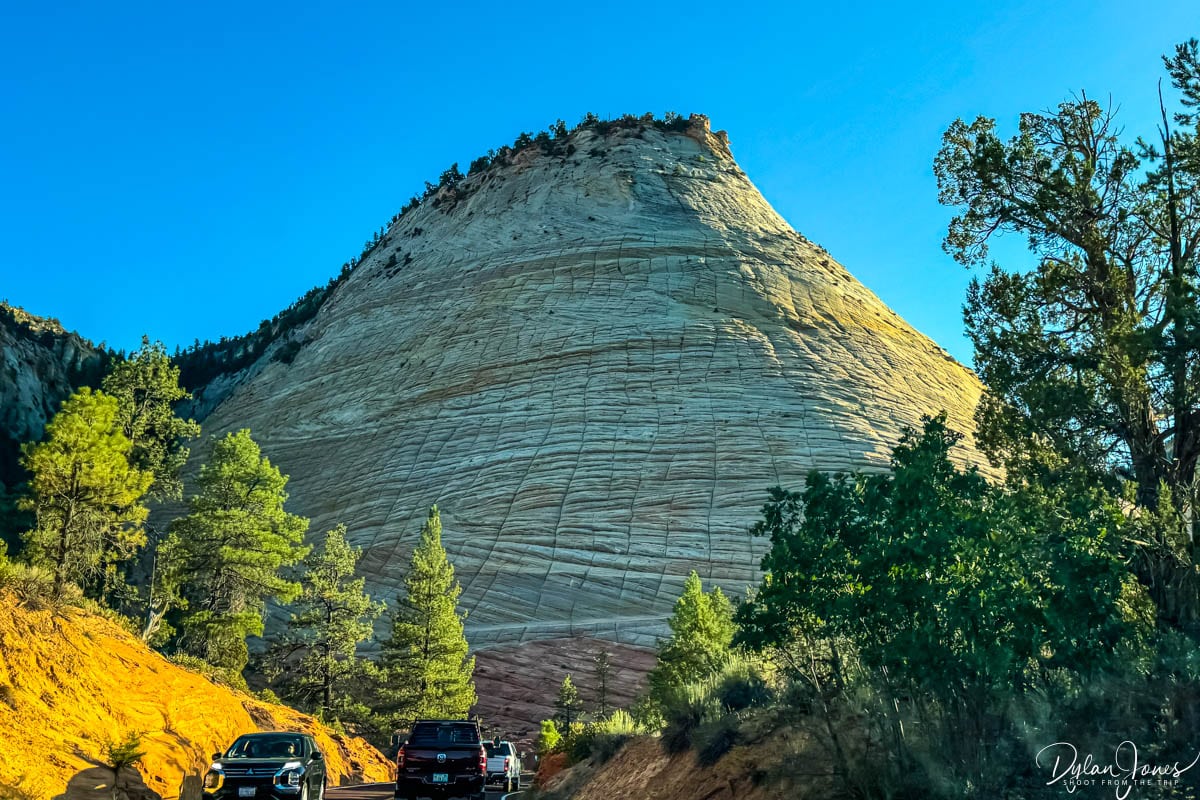
With a journey of just under two hours to the entrance of ZION NATIONAL PARK, we had planned to stop along the Zion – Mount Carmel Highway, and embark on a short hike along the CANYON OVERLOOK TRAIL. Sadly, as we had no faith the car would start again, we were reluctant to stop before arriving at our accommodation in Springdale. Heading into Zion National Park, the scenery changed quite dramatically with sandstone cliffs in shades of pink and creams, a huge contrast to the reds and oranges we had been used to. The scenic route into Zion was extremely beautiful, passing by landmark formations such as CHECKERBOARD MESA.
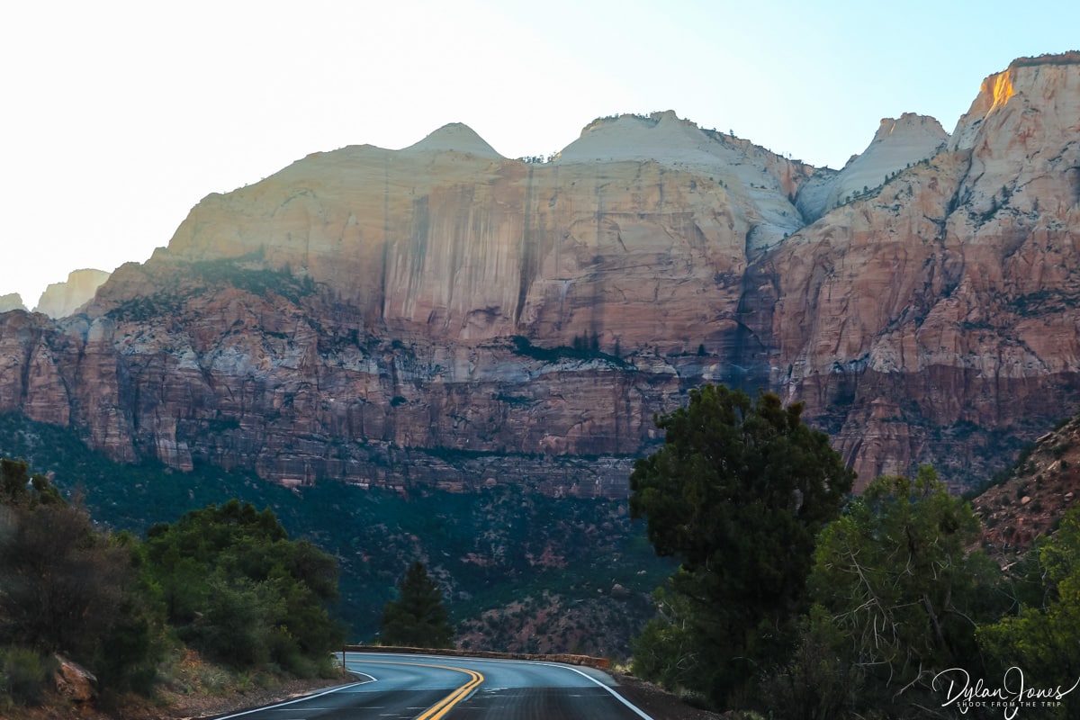
If there’s one view you can’t miss when visiting Zion National Park, it’s the view of the park after passing through the Zion – Mount Carmel Tunnel. This 1.1-mile-long tunnel provided entry to Zion National Park from the east, and when exiting the western end of the tunnel, the reveal was jaw dropping. Towering mountains and cliffs in hues of pink and cream appeared ahead, as the road took a series of switchbacks down to the valley floor.
WHERE TO STAY IN ZION NATIONAL PARK?
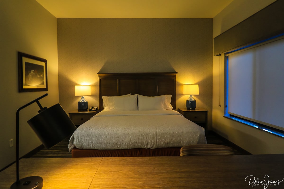
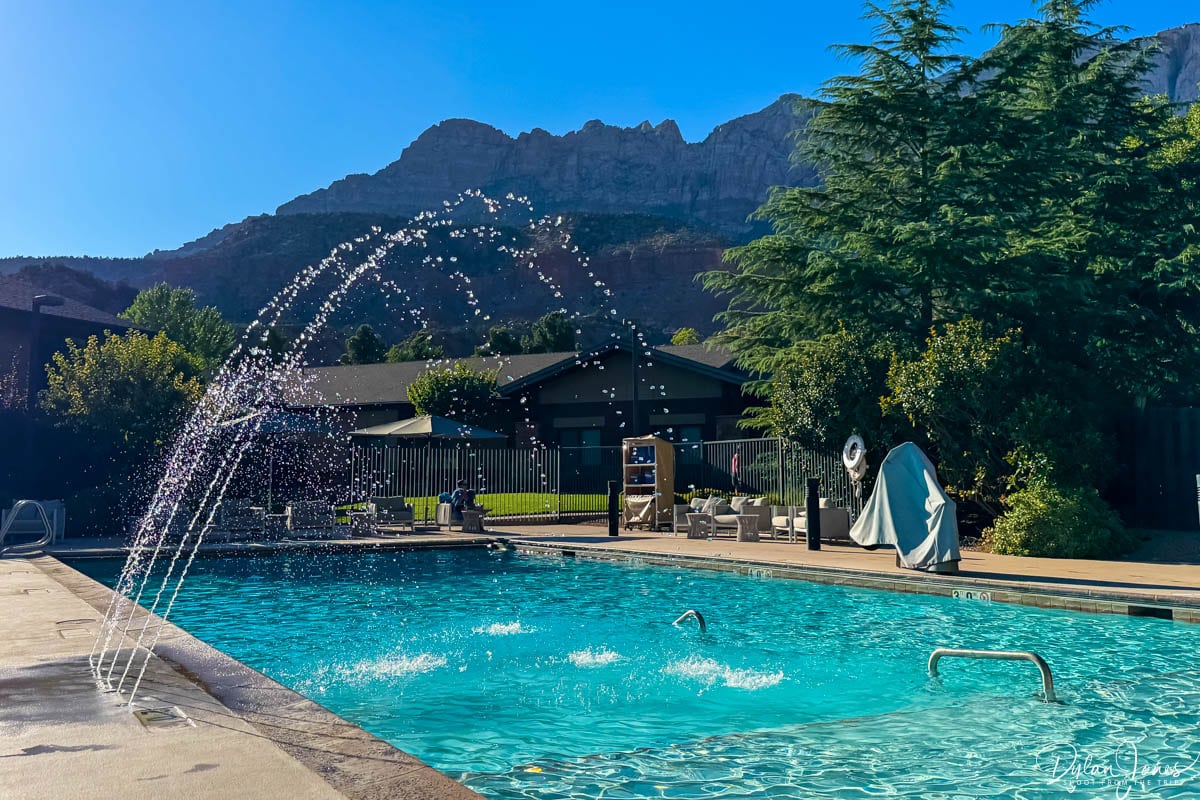
Our two-night stay was at the HAMPTON INN AND SUITES in the town of Springdale near the southern entrance of Zion. This hotel, located centrally in the town, was in the perfect spot to explore locally with several nearby restaurants and bars. With the addition of a pool area, there was also the opportunity to relax and soak up some sunshine towards the end of our Utah road trip.
UTAH ROAD TRIP DAY 8 – E-BIKING IN ZION
ZION NATIONAL PARK (CAR FREE DAY)
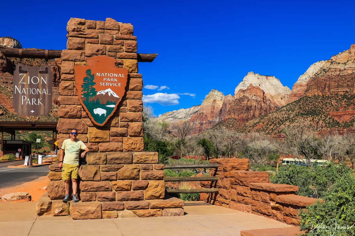
The final day of our Southern Utah road trip arrived, finishing off at the last of the Mighty-5 national parks, Zion National Park. Having researched Zion, my main takeaway was that it would be busy. My second takeaway was that making the most of our only day at the park would be problematic if using the park shuttle service. During the busier times of year, Zion National Park does not allow public traffic into the park apart from guests staying at the Zion National Park Lodge. While the shuttles are very regular from the Visitor Center, there can be considerable queues during peak times of the day. For this reason, and I’m glad I did my research, we opted to hire E-Bikes.
GREATER ZION E-BIKES
Luckily for us, the building next door to our hotel was home to Greater Zion E-Bikes, offering a selection of E-Bikes and equipment. Located less than two miles from the park entrance, it was the perfect solution to make our day more relaxed. For a full 8-hour day, we rented two RAD RUNNER bikes for $80.00 each, which included a rear basket, a helmet and bike locks.

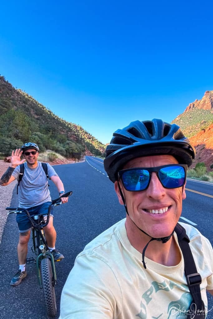
EXPLORING ZION CANYON
Collecting our bikes at 9.00am, we were given a basic rundown on how they worked before getting on our way. From Springdale, we cycled to the Zion Canyon Visitor Center, crossing the shared pedestrian entrance bridge and through the park entrance booths. We then joined the PA’RUS TRAIL, a multi-use paved pathway running alongside the Virgin River towards Zion Canyon. Reaching Canyon Junction Bridge, the trail ended and merged with Zion Canyon Road which ran north for seven miles.
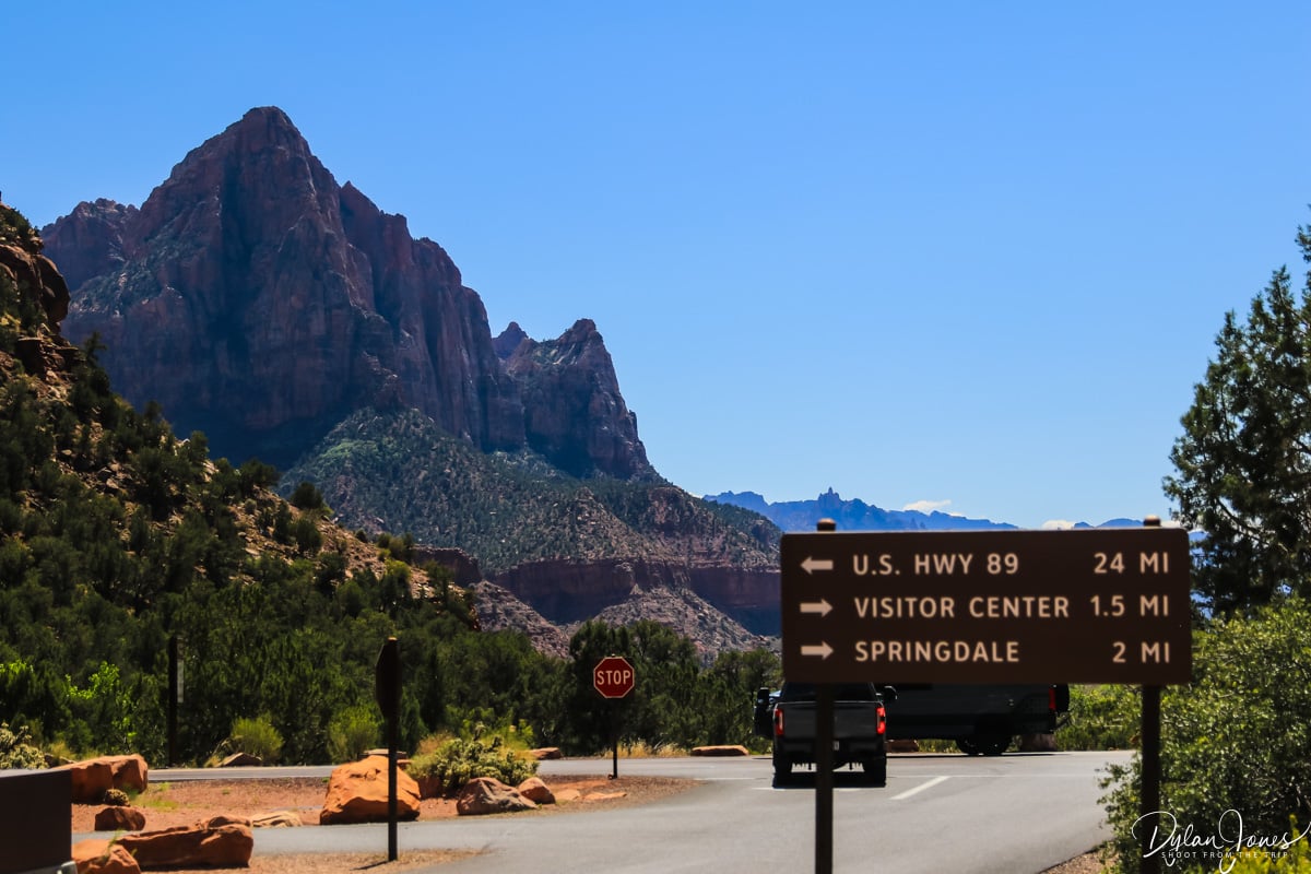
With no traffic other than the shuttle buses and the occasional car, cycling in Zion Canyon was pure joy. The route along the way featured several stopping points, either at trailheads or scenic viewpoints, all of these having bike racks. Our plan was to cycle to the far end of Zion Canyon Road and make our way back down through the day. There are a number of popular hikes in Zion National Park including The Narrows, Angel’s Landing and the Emerald Pools Trails, but due to the time limitations, we didn’t do any of the longer hikes this time. We just enjoying cycling and taking in the scenery.


First stop, we locked up our bikes at the TEMPLE OF SINAWAVA and headed for a hike along the RIVERSIDE WALK. This 2.2-mile round trip hike headed into the canyon towards the starting point for The Narrows hike, which drew in crowds of people geared up with hiking sticks and waterproof gear. The Riverside Walk, whilst incredibly beautiful, was the busiest hike of our entire trip.
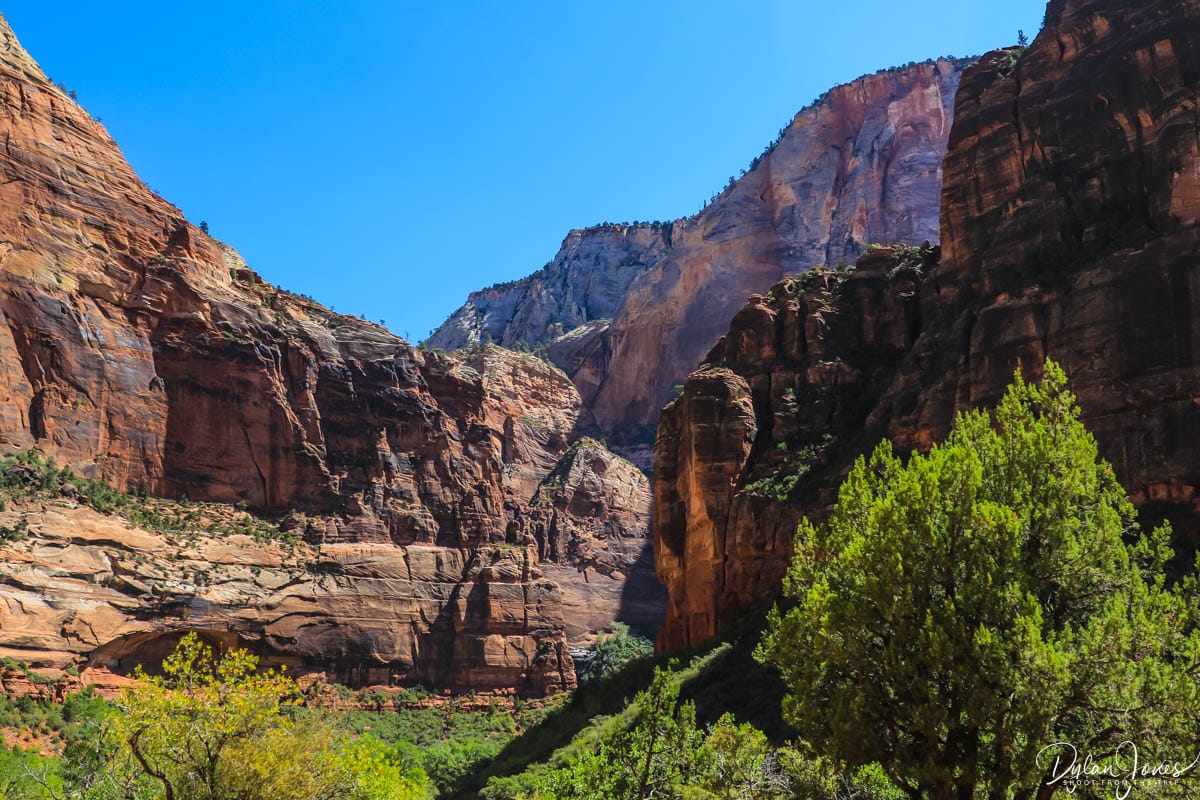
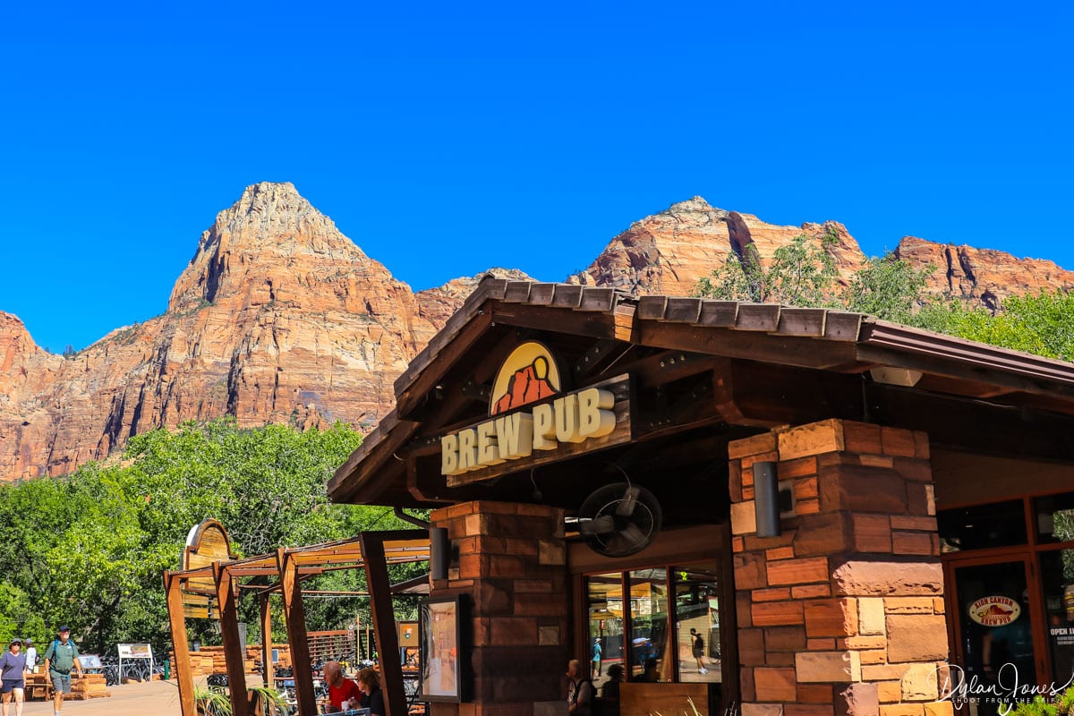
Heading south, our stops included BIG BEND and THE GROTTO, before having lunch at the Castle Dome Cafe at Zion Canyon Lodge. We continued south towards COURT OF THE PATRIARCHS before finally joining back onto the Pa’rus Trail to reach ZION CANYON VILLAGE. This lively hub was a great place to stop and peruse the gift shops before grabbing a refreshing local beer on the outdoor deck of the ZION CANYON BREW PUB.
Arriving back to the hotel late afternoon, we spent a couple of hours lounging at the pool before heading out for our final dinner of the trip. Wandering across back to the hotel, we gazed up at the clear skies packed full of stars and savoured those final moments of this incredible trip.
It’s always difficult to compare US road trips, but I would rate our Southern Utah road trip as one of the best. I was genuinely in awe of some of the places we’d visited during our stay, yet we barely scratched the surface of places we could have seen. There’s always a next time though, isn’t there?
RELATED CONTENT
EXPLORE CALIFORNIA’S INLAND DESERTS. SEE THE BEST PLACES TO VISIT IN CALIFORNIA’S EASTERN SIERRA
LOVE THE WILDERNESS? THE BEST HIKES, SCENERY AND ACCOMMODATION IN SEQUOIA NATIONAL PARK
EXPERIENCE JAW DROPPING LANDSCAPES ON A YOSEMITE 3 DAY ITINERARY
SOCIALS
If you enjoyed this article about the fabulous North Wales activities to get the adrenaline pumping and found it useful, please leave a comment in the box below or Pin one of the images below to PINTEREST.
For regular photo updates on my travels, follow my account on INSTAGRAM and TIKTOK.
Scroll down (on mobile) to subscribe and get new post alerts directly to your inbox. If you’re on desktop, head to the right hand sidebar and pop in your email address.





Yay, thanks for a lovely Sunday morning read. I love southern Utah, and you visited places I’ve still never been. Zion will always be my favourite though, I do hope you are able to go back someday and spend a few days hiking. It’s a magical place.
I’d love to go back to Zion. I think because it was at the very end of the trip we were a bit frazzled and overwhelmed, so we didn’t really have the time or energy to soak it all in!
Yes you really covered a lot of ground! Another time hopefully!